
Hurricane Dennis
September 1999
Quick Facts
Storm Type | Cat. 2 Hurricane
NC Landfall | Cape Lookout
NC Wind Speed | 105 mph
NC Storm Surge | 11 ft
NC Rainfall | 7 in
NC Pressure | 28.23 in
Total Deaths | 4
Total Cost Then | $157,000,000
Total Cost 2009 | $
About this storm
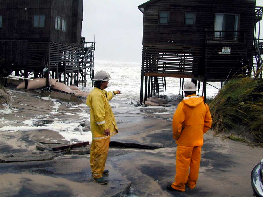
Dennis (August 30-September 5, 1999) Through the early weeks of summer 1999, tourism was booming for most of the resort properties and beach businesses that cater to seasonal crowds on the North Carolina coast. Even though another dire hurricane forecast been issued for the Atlantic, vacationers packed the beaches to soak up the sun and play in the surf. The peak tourist season was becoming increasingly compact, however as families planned their vacations around return-to-school schedules that crept toward early August. But property agents noted that those interested in beach house rentals were beginning to avoid late August bookings for another reason- the potential threat of yet another hurricane on the Tar Heel coast.
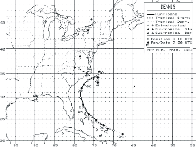
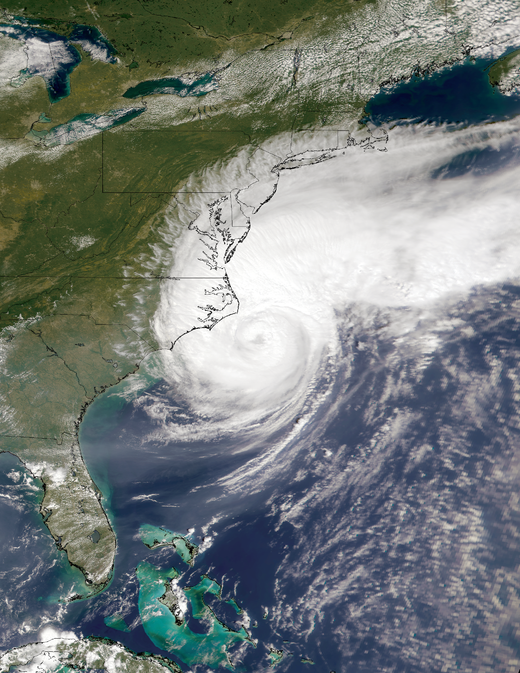
As residents and vacationers looked ahead to the approaching Labor Day holiday, their attention was soon focused on Hurricane Dennis, a larger-than–average storm that formed near the Bahamas on August 24 and reached hurricane strength two days later. It produced near hurricane conditions at the Abaco Islands on the twenty-eighth and then intensified later that night, building sustained winds of 105 mph. It maintained category 2 intensity for the next two days while paralleling the southeastern U.S. coast about 115 miles offshore. As it began its approach to the Carolinas, it slowly weakened and moved to within about sixty miles of the frequent hurricane target, Cape Fear. For a while, it looked like the beaches from Wrightsville to Topsail would catch another direct hit.
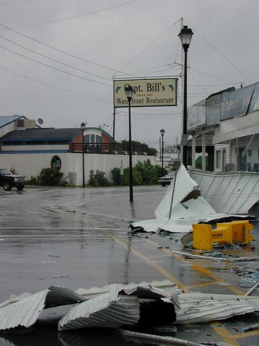
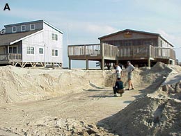
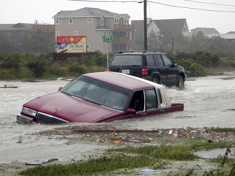
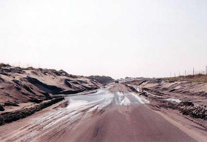
Throughout its development and movement northward, Dennis was never a classic tightly wound hurricane. Westerly wind shear persisted throughout much of its course, and its large, forty-mile-wide eye was often poorly defined. Once the storm closed in on North Carolina on August 30, it encountered a midlatitude trough that steered it toward the north and northeast, pushing it out to sea off Cape Hatteras. At the same time, extensive weakening occurred. This was good news at first since the southeastern portions of the state were spared landfall. But Dennis’s large wind field extended for 200 miles in every direction around the storm’s center, pushing tropical-storm-force winds of 45 to 65 mph onto the beaches.
— Excerpt from North Carolina’s Hurricane History by Jay Barnes, Fourth Edition
Through the Lens
Media, PublicationS, & Reports
A FEW HeadLINES
"Hurricane Dennis Has Mercy on Atlantic Coast" via The Washington Post
"High winds, rain anticipated as Hurricane Dennis brushes Carolinas" via CNN